
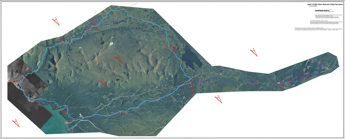
2022 Silver Sled.
The 2022 Race follows the traditional race route along the pipeline trail between former Bear Creek Lodge to Silver City. There are 2 highway crossing which are both manned. One is about 6 miles past the start and the other is about 4 miles before the finish in Silver City. The trail begins on the right ( north side ) of the Alaska Highway. At Bear Creek Summit it crosses to the left side ( South side ) of the Alaska Highway. Rolling Hills till the trail crosses back to the right sight of the Alaska Highway before finishing at the Arctic Institute in Silver City.
https://1drv.ms/u/s!AmYzHQy2k4l6hRW40JVHV9nYcbme?e=B2le0Y
Above is a link to final maps for the Silver Sled and Chili Paw Races. If you just want a simple map to look at, download the "Standard PDF". It's available in three qualities.
For tracks see the track folder.
There are oodles of georeferenced formats to choose from including GeoTiff, kmz, Geospatial PDF, and MB Tiles. The GeoTIFF and Geospatial PDF should work with the 'Avenza Maps' app. A far better app for Android is 'Orux'. The MB Tiles, along with the track files, work great with Orux.Beaver Mapping has this year's Silver Sled map ready to download.
Visit their facebook page :
www.facebook.com/Beaver-Mapping-1845044055766251/